Wednesday, November 11, 2015

Barbary Coast Trail, San Francisco

For my husband's birthday this year, we decided to go to San Francisco, which is about a 5 hour drive from where we live.  Unfortunately, we only had enough time to spend a day and a half in the city because Jeff needed to be back to start a new job.  But fortunately, that gave us enough time to see a lot of stuff, mainly due to the fact that we walked the Barbary Coast Trail.

The "trail" is actually a walking tour of San Francisco that starts in downtown and winds its way through the city, finally ending at Fisherman's Wharf.  It's about 4 miles, depending on how many alternate routes and detours you take.  The trail was promoted by the San Francisco Historical Society, so its main purpose is to take you through historic neighborhoods, which was A-OK with me.

Phase I: Getting to the Trail

Whenever Jeff and I visit big cities, we generally ditch our car and take public transportation.  We stayed in Oakland where hotel prices were about half what they were anywhere else in the Bay Area. Oakland has kind of sketchy reputation but we didn't think it was that bad.  The biggest benefit of staying in Oakland, however, aside from the cheap hotel prices, was that we were less than 2 blocks from a BART station.  Bay Area Regional Transit is a train/subway system that runs all over the Bay Area.  So for, $3.50 we had a stress-free, 20 minute ride into San Francisco AND we didn't have to worry about parking.  The downtown San Francisco BART station is right at the beginning of the trail, so we arrived exactly at our jumping off spot.  If you were to drive to San Francisco, there is also a parking garage right at the start of the trail.

Phase II: Navigating the Trail

The trail starts right in downtown San Francisco near Powell Street. The Historical Society has placed 180 large bronze medallions at every intersection of the route.  Each medallion is stamped with Barbary Coast Trail and includes arrows to point the way.  We carried a map of the route and I'm glad we did.  There was a lot of construction going on in downtown and a few of the medallions were either removed or covered up, so we ended up taking a couple of unintentional detours.  There is also an app you can download that will guide you along and also provides interesting information on the history of San Francisco.  We didn't have any kind of guide, just the print-out of the map but we had an amazing time anyway.  I spent the entire day oohing and awing constantly.

One of the bronze medallions.  They're about 1 ft. in diameter, so quite noticeable.


Phase III: The Trail

Wow.  I think I said "wow" about 20,000 times during the walk.  In the past when Jeff and I have come to San Francisco, we've driven, which was a huge mistake.  Generally what happens is that we bicker the whole time.  I'm driving and he's navigating and we're both pretty lost and frustrated with all the one-way streets and odd intersections. We spend the whole time looking at maps and trying to figure out where we are and where we're going.  But when you walk through San Francisco, you have time to pause and look at stuff, pop into stores, take photographs, and generally just toodle along at your own pace.  The Barbary Coast Trail is THE way to do this.  The route takes you down streets and through alleys that you probably wouldn't normally go down.  You get to see hidden treasures along the way like little parks and neighborhoods most non-residents don't know about.

The trail starts in downtown San Francisco (although you could totally do it in the opposite direction too).  Downtown is all about famous stores and giant skyscrapers.  Nordstrom's, Saks Fifth Avenue, Macy's.  Amazing luxury hotels in historic buildings. Street performers.  When we were there, they were setting up a huge Christmas Tree in Union Square.  

The start of the trail.


After strolling through downtown for a while, you end up in Chinatown.  We were there on a Friday so the hordes of tourists that are generally in Chinatown were noticeably absent.  Usually I like to go into some of the stores to see what treasures can be found but I didn't want to have to carry any purchases while we were walking.  Instead, we just gawked at everything.

The Dragon Gate leading into Chinatown.


I like the old YMCA sign on the left.  On the right is s church made of clinker brick.

We saw these benches with Chinese zodiac signs in a little side street.  There were others with different animals too.


The trail took us down this alley, which seemed more authentic than the touristy bits of Chinatown.

I really liked this building.  I like the little apartment that was tacked on the top.

Trail food, Barbary Coast Trail style.  This was in a little dim sum restaurant.

These men were watching a hot game of either Go or Mahjong, I'm not sure which.

After Chinatown, the trail took us through the oldest part of town.  There are a few buildings left from the 1850s.  The crazy thing is that those buildings used to be on the waterfront but are now about 15 blocks inland.  The San Francisco Bay has been filled tremendously to accommodate growth of the city.

This was an interesting building.  The bottom part, made of brick, is the original 1850 US Mint in San Francisco.
Right over the top of it is a modern skyscraper.

The famous Transamerica Building next to buildings from the 1870s.

I was trying to center the building for this shot but I couldn't make it work.

The old Transamerica Building.

Next, we got to see an Italian neighborhood that I never knew existed.  It looks like it's become a pretty hip part of town.  In this section, we also got to start climbing Telegraph Hill.  We chose to take the detour to Coit Tower, which was a hefty climb but totally worth it for the views.

Italian neighborhood.

I'd been trying for a while to get a complete shot of the Transamerica Building.
I finally did as I crossed a street.  I love the copper colored building to the right.


Cool trees in Washington Park.

A typical Telegraph Hill neighborhood looking down on a Catholic church.

Coit Tower up a steeeep hill.

Just a shot to show how steep the hills are.

When we got to the top of Telegraph Hill at Coit Tower, we took a break.  We definitely needed it!  The hill has really nice views of the bay and San Francisco.  You can go up in Coit Tower but there was a long line, so we didn't go up.
Looking toward the Golden Gate Bridge from Telegraph Hill.

This sign was warning that coyotes had been spotted on Telegraph Hill!

Green Tea Kit Kats that we scored in Chinatown. 

The wrapper, mostly in Chinese. I thought the Kit Kats were just OK.  They tasted mostly like white chocolate.

After we clambered back down Telegraph Hill - OOF!!  We ended up at Fisherman's Wharf.  This was probably my least favorite part of the trail simply because it's so touristy.  But we enjoyed the views of Alcatraz and the Maritime Park was really nice.  The trail follows Embarcadero for quite a ways and then ends up on the waterfront right at a Cable Car stop.  We were pretty wore out and foot-sore by this point, so it was nice to ride the cable car back to downtown.  I've never ridden the cable car, so it was pretty exciting.  I know it's a very touristy thing to do but it was actually really cool and fun.  Plus it felt good to finally sit down after pounding the pavement for 4 hours.

A historic street car on Embarcadero.

Alcatraz from Fisherman's Wharf.  That dark blip to the left of Alcatraz is a Chinese Junk.

This was a railway arch leading to the shipyard.

Ghirardelli chocolate factory.

This was an interesting complex of buildings that was a bathhouse and swimming area in the 1920s.

Our chariot.

Wow.  The cable cars go up some super steep hills.

Going down a super steep hill in the cable car.
According to my Fitbit, we walked nearly 8 miles but I think the Fitbit was occasionally confused.
In the end, it took us about 4 hours to complete the Barbary Coast Trail.  You could easily make it a full day with shopping and gawking.  I highly recommend this walk through San Francisco, it was one of the funnest things I've done in a long time.


Saturday, October 31, 2015

I Love Wild - Bring It On

Here’s my Wild “confession.”  I’ve read Wild twice and enjoyed it thoroughly both times.  Yeah, I’m one of “them.”  One of those Wild fans who read the book and ran straight out and tried to hike the PCT. 

Actually, no, that’s not quite how it happened.

I’ve had this strange ambition to walk a really long distance for a long, long time.  Seriously, since I was about 9 or 10.  That desire has stuck with me all of my life but unfortunately I never made it happen.  My trajectory took me in other directions.  And then I turned 40 and I had, I dunno, call it a wake up call or, heck, a mid-life crisis.  I suddenly realized that I wasn’t getting any younger and I had better get working on this long distance walk thing or I might never get the chance.  I know that a few folks continue backpacking into their 60s and 70s but I wanted to do it now, when I was still reasonably young and my body could handle it better.

The year I turned 40, my friend Melissa completed about 300 miles of the PCT in Oregon.  Listening to her talk about her adventure, a light bulb clicked on.  That was it!  I could hike across Oregon.  While I had known about the PCT for several years, it hadn’t occurred to me that it was the perfect solution to my long distance walking ambitions.  So, I started thinking about and planning my adventure just as countless PCT hopefuls do every year. 

That was October 2013.  Two months later, my mother-in-law gave me a copy of Wild for Christmas.  I loved it.  I thought to myself, “This girl did what I’m going to do!  How cool is that!”  I had no idea at that time, when my plans were in their infancy, that there was this whole big “thing” about the PCT going on.  I had no idea that more and more people were tackling the PCT every year.  I had no idea that there was something called a “thru-hiker.”  All I knew was that I was seriously pumped to walk across Oregon and this amazing, funny, sad, and touching book strengthened my resolve to go out and do it.

My Initial Reaction to Wild

As I said, I received Wild for Christmas in 2013.  I devoured it in 2 days.  I was completely caught up in Cheryl Strayed’s story.  From the heartbreaking loss of her mother to her terrible decisions following her mother’s death – I was enraptured.  For me, on that first reading, the PCT merely formed a backstory.  It was the linear backdrop to a story that meandered from the present to the far away past.  It anchored the story in the now.  I loved her descriptions of being on the trail and her self deprecating humor.  And I did think, “geez, she never tried packing her backpack before she went?!”  I laughed and cried and smiled and marveled every page of the way.  But importantly, at no point did I think “This is the greatest book about backpacking I have every read!  I want to be like her.”  For me, the book was about Strayed’s personal journey to recovery, every messy step of the way – and I’m not talking about hiking.  Strayed is incredibly forthright and truthful about what she went through with depression, infidelity, and drug use.  And that’s the point.  The hike and the book were her catharsis.

My Second Reading of Wild

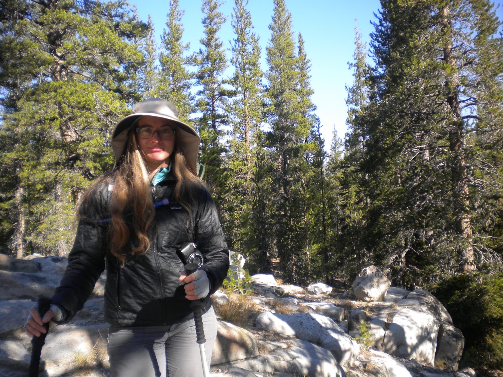
So, inspired by many things, including Wild, I set forth in August 2014 to hike across Oregon.  Sadly I only made it 210 miles before injury ended my trip (I will be back!).  I dealt with some pretty serious self doubt and depression when I returned from my trip.  My failure stuck with me and for months I couldn’t stop thinking about my trip and making plans to go back and accomplish my dream.

During this time, the movie based on Wild came out.  Of course I had to go see it.  I was excited to see the landscapes I had seen in Oregon and to relive some of my trip.  I found the movie to be thoroughly disappointing.  Reese Witherspoon just didn’t fit my image of Strayed.  Witherspoon in all her sweetness just couldn’t pull of the proper level of ‘90s angst Strayed went through and although they supposedly packed her backpack full of gear, she just never hit that backpacker stride that comes from walking many miles.  Most disappointing of all, the amazing PCT landscapes that I love weren’t there.  The shots were too tight – filming couldn’t occur in wilderness areas, so they found substitutes and shot scenes tightly to cover up the fact that they weren’t really on location.  I also took deep umbrage to the fact that they showed Strayed camping on the rim of Crater Lake, which is illegal and did not happen in reality.

Disappointed with the movie, I decided to re-read the book.  My second reading was a bit different than the first.  I knew what to expect from her emotional journey so that part wasn’t as engaging as it had been the first time (but still SO good).  What I focused on, probably stemming from the disappointment I felt over my “failure,” were her descriptions of hiking.  As I read, the book, I definitely noticed that Strayed moved locations around to suit the story.  But reading her descriptions of life on the trail, I also found myself smiling ruefully and thinking, “I know exactly what she’s talking about.”  Her disappointments and victories on the trail were very much like my own and will probably resonate with anyone who’s backpacked long distances.  Reading her descriptions of the trail and her hike I thought, “Guys, she’s legit.  She’s been there.”

STFU and HYOH

I’ve seen quite a bit of vitriolic negativity thrown toward Strayed and I personally don’t get it.  My sense of things, as I watch from the sidelines (until now), is that most of the haters haven’t read the book.  They’ve maybe watched the movie but I think a lot of people are just riding the Strayed Hate Wave to fit in and are repeating the same BS about how dumb and unprepared she was.  God forbid anyone should stand up for her, especially in a group as conformist as thru-hikers.  There is also a subset of people who read the book but didn’t get it.  I think what people get out of the book has a lot to do with their expectations of it.  Like I said, when I read it, I was going in blind.  I knew the PCT existed and I knew that I wanted to hike part of it.  But I didn’t know much more than that and thus I also didn’t know what to expect from the book so I just rolled with the story and got caught up in it the way Strayed intended.  On the other hand, there are people like my friend Melissa and my mother-in-law who read the book expecting it to be a description of Strayed’s backpacking trip and were thus disappointed in her naïveté and, as Melissa puts it, her “stupidity.”  I’ve heard that others hate the book because they thought it would be a how-to guide for the PCT.  God, it bugs me when people talk shit about something when it isn’t what they thought it would be.  Get over it.  Love it or hate it based on what it is, not on what you think it should be.

What bugs me in particular about the Strayed haters is that they’ve forgotten the mantra of the PCT and all backpackers – HYOH.  Hike Your Own Hike.  Why is everyone wasting so much energy tearing down a fellow backpacker?  I have several theories but I think it comes down to this: thru-hikers are pissed that their little secret is now main stream.  It’s like they’re afraid Oprah’s Book Club is going to take over the PCT and armies of ill-prepared middle aged women are going to be clogging up the trail.  And while there are more hikers on the trail with each consecutive year, I really don’t think Wild has much to do with it.  During my short time on the PCT in 2014, the most common backpacker I saw was a 20-something, white, college educated male - and I sincerely doubt any of them read Wild.  As things have a tendency to do, the PCT is building on itself.  As more people do it, more people learn about it and want to attempt it themselves.  That’s how I arrived at my decision to hike it.  Either by design or happenstance, Wild came out just when the interest in the PCT was growing exponentially.  The snowball was already growing when Wild came along.

I’m sure few people in the hiker community will take my opinion seriously since I’m only a section hiker - and a failed one at that - but I felt the need to defend a book that I really love.  Read the book and love it or hate it but geez, form your own opinion about it instead of repeating the same BS everyone says.  More than anything, get over it.  Stop using a book and a single person as your scapegoat for the problems with the PCT.  Seriously people, STFU and HYOH.  

Monday, September 28, 2015

Day Hiking in Yosemite: Day 3

For our final day in Yosemite, we wanted to do one last short hike before heading home.  We both agreed that something in Tuolomne Meadows was ideal because 1) it was on our way home and 2) I could get my passport stamped at the visitor's center at TM.  After the fiasco of the day before, I was even more determined to get my passport stamped.

So we ended up hiking out on the Lyell Canyon Trail, which is a segment of the John Muir Trail/PCT.  Knowing that we wanted to get home at a decent time, we gave ourselves 2 hours of hiking in each direction rather than pick a specific spot to get to.  It was nice and relaxing feeling that we didn't have much of a goal. We started out near the Lake Catherine trailhead and headed east.  The trail for the first 0.5 miles was a nasty, tore-up mess.  The ground was rocky and hikers and equestrians had walked all over the place to find the smoothest route.  But as we moved past the trail to the visitor center, the trail improved and became a nice little footpath through the trees.

The hike wasn't terribly scenic but moving down the trail was pleasure in itself.  As my friend says, "it smells like the outdoors."  Yes, Melissa, it did.  Piney and dusty and fresh.  After the debacle of the day before, this trail was peaceful and soothing.  As we neared our turn around point, we spotted a nice flat area by the river and sat down for a break.  I took my shoes off and stood in the water.  Holy moly was it COLD!!  I grew up going to Lake Tahoe and the coldness of Tahoe has nothing on this stuff.  But my feet loved it.  They felt all tingly and refreshed when I got out.

On the way back, we went down a side trail to the visitor center and I finally got my passport stamped.  But just to finish the trip off right, I accidentally stamped it upside down.  Because of course I did.  Sigh.

Melissa looking like Mountain Girl.

Peaceful trail.

Our spot by the river.

Day Hiking in Yosemite: Day 2

Day 2 of our Yosemite Trip was a comedy of errors.  Our plan had been to hike up to Glacier Point on the 4 Mile Trail. Yeah sure, we can do that.  Easy.  Right?  Heh.

So the day started off with us bumbling around Yosemite Valley.  I wanted to get the Yosemite stamp for my National Park Passport, so we parked the car near the 4 Mile Trail and decided to walk over to the visitor center.  Half way there, I realized two things.  1) I'd forgotten my passport in the car and 2) I'd forgotten to bring a lunch.  Sigh.  But we soldiered on.  We were almost to Yosemite Village anyway.  At the store, I picked up a Clif bar - just like the one I left at camp - and we perused the souvenirs a little.  On the way back to the car, we decided to catch the shuttle, which supposedly would drop us "near" our car.  I guess 1 mile from the car is "near."  Anyway we finally got back to the car, grabbed our backpacks and made our way to the trailhead.

Our first inkling of trouble was when we got to the trailhead, which listed the mileage to Glacier Point at 4.6 miles not the 4 we had been expecting.  Our next inkling came from gazing up at what we guessed was Glacier Point - waaaaaay up above us.  Now, I knew it was going to be a crazy slog to get up there but I didn't realize just how crazy until I started climbing.  The trail appears on maps as a death slog of switchbacks with a seemingly flattish spot in the middle with a second set of death by switchback.  We made it past the first set of switchbacks and started the second set and then I just quit.  My legs were shaking and I was totally out of gas - and we weren't even half way to our destination.  I swallowed my pride and made a command decision, to stop where we were and go down.  My friend is in better shape than me and probably could have gone on but she agreed.  And I'm glad she did.  We were WIPED for the rest of the day.  But we did get to see some pretty awesome views from the trail.  Had Yosemite Falls had any water in it, we would have gotten some really stunning views of it.

In the end, we drove up to Glacier Point (a surprisingly lengthy drive).

Our day continued to be a tad effed up all the way back to camp.  After visiting Glacier Point, we drove back to Yosemite Valley because I was determined to get my passport stamp.  We arrived 30 minutes after the visitor center closed.  Sigh.  But we trotted over to the store where we bought some souvenirs and I bought a Tasty Bite for dinner.  Then we took off for our camp...and totally missed the turn to the Tioga Road and ended up at Hetch Hetchy.  "Wait I don't remember there being a fee station on the Tioga Road..." Sigh. By this time we were fed up and tired.  We got back to camp at about 8.  But my Tasty Bite dinner made it all better.  The microwaveable ones fit into my Jet Boil.  Just plop the bag in a Jet Boil for a couple of minutes in boiling water and voila! Delicious Indian food for dinner.  I recommend cutting the bag to vent and not filling the Jet Boil to the fill line to avoid overboiling.

I could be wrong but I'm pretty sure that's Glacier Point.  Way up there.

"4 Mile Trail" my ass.

Death by switchback.  This picture makes it look kind of tame but it was freaking steep.

Yosemite Falls is that stain in the middle.  No water, alas.

We did manage to get pretty high above the valley before we quit.  This is looking west.

Looking west again.  That's El Capitan on the right and Yosemite Valley waaay down there.

Final view of our goal...which we never got to.

We made it...by the power of turbo diesel. 

Yosemite Valley is waaay down there.

Absolutely stunning.