However, as an archaeologist, this is one of the coolest places to be in the state. Fallon is right at the heart of ancient Pleistocene Lake Lahontan, a lake so big that it covered most of Northern Nevada - waxing and waning for about 100,000 years. The first people in Northern Nevada, estimated to have arrived around 12,000 years ago, would have seen the final remnants of this enormous lake in the form of lakelets and marshes. Today, we still have a few bits and pieces of the lake left - Pyramid Lake, Honey Lake, and Walker Lake as well as large marshes including the Stillwater Marsh and Carson Lakes near Fallon. The hills around Fallon bear witness to the ancient lake in the form of shorelines that are clearly visible as "steps" in the hillsides.
Archaeologically, this resulted in a rich history of human use in the valley. Pretty much all of Nevada is some form of desert - "high desert" in Northern Nevada and "hot desert" in Southern Nevada. Northern Nevada is also the heart of the Great Basin, a large physiographic region that is characterized by high elevation (3,500 amsl and above), cold winters, hot summers, and low precipitation. It's called the Great Basin because this is where rivers come to die. Early Euro-American settlers were amazed to see rivers simply disappearing into "sinks" with no visible body of water like a lake. The Lahontan Valley, where I live, is part of the Carson Sink, which is where the Carson River comes to die - although technically it feeds the Stillwater Marsh and Carson Lakes (which one depends on several hydrologic factors that I'm not going to get into and, not to mention, the Carson River has since been dammed and channelized into irrigation canals but that's a whole other story).
So anyway, the Lahontan Valley is unique in an area characterized by lack of water. Large marshes and lakelets have occupied the valley since the final high stand of Lake Lahontan around 15,000 years ago. Marshes are a rich source of resources including edible vegetation, waterfowl, fish, and freshwater mollusks. Because of this, there has been a long history of human occupation in the Valley, something not seen elsewhere in Northern Nevada. Most Great Basin prehistoric groups traveled seasonally following resources as they became available. This was less true in the Lahontan Valley because of the year-round availability of resources. The groups here might venture out to seek resources not available in the valley (obsidian, large game, pine nuts) but they seem to have mostly stayed put, especially starting in the Late Archaic, which was a period characterized by warmer temperatures and low precipitation.
OK, so why I am explaining all of this on a blog that is supposed to be mostly about hiking? Grimes Point. I have very few hiking opportunities in the Lahontan Valley due to its flatness. I do go out on the Emigrant Trail quite often but it's flat and not very scenic. It's great for walking long distances but that's about it. Grimes Point is my other go-to hiking spot because it presents some nice topography for building hiking legs. It is, however, one of the most important archaeological areas in the state.
Grimes Point is famous for three things - Hidden Cave, Spirit Cave, and the Grimes Point petroglyphs. Hidden Cave is a "cache" cave that has aided archaeologists in establishing the Great Basin timeline. It contains stratiphied deposits in dateable contexts that were the basis (along with Monitor Valley finds) for establishing the typology of our most diagnostic artifacts - projectile points. Spirit Cave is where mummified human remains were found in the 1940s. The remains have since been radiocarbon dated to 9,500 years ago, the oldest mummified human remains ever found in the United States. Finally, the Grimes Point petroglyphs are one of the largest collections of their type in Nevada. So yeah, a lot going on at Grimes Point.
There are several trails at Grimes Point but most of them are interpretive trails. The Petroglyph Trail is closest to Highway 50 and there is a parking lot, pit toilets, and picnic tables available for visitors. The Petroglyph Trail is about 0.5 miles long and winds among boulders with petroglyphs. I recommend walking the trail in both directions because you'll see more if you do that. The other interpretive trail is down a dirt road from the Grimes Point parking lot. This trail winds around a hillside showcasing several cave sites including Hidden Cave. This is a self guided tour and there are usually pamphlets available at the parking area. There is also a pit toilet available. These trails are a bit more rugged than the ones on the Petroglyph Trail, so not appropriate for the elderly or handicapped. Hidden Cave itself is open for tours every other weekend and anyone interested can sign up at the Churchill County Museum on Maine Street in Fallon. Otherwise, Hidden Cave is locked up behind a stout iron door. It was vandalized this year, the vandals going so far as to get through the door and spray paint over the archaeological deposits. They still haven't found who did it.
OK, so the trail that I do is not technically an official trail at Grimes Point, although following the vandalization at Hidden Cave, the Bureau of Land Management conceded that the trail was being used and improved it in the hopes that people would at least stay on it and not be tempted to make new ones. I start at the Petroglyph Trail parking lot and follow the trail up to the Overlook, which is an official trail. The trail winds up to the Overlook and there is a nice bench and a couple interpretive signs that explain the history of the Lahontan Valley. You can see Naval Air Station Fallon from here - that's where I work!
From the Overlook, the "unofficial official" trail goes east, climbing up a couple of good grades before reaching the top. From the parking lot to the top, it's 1,000 ft of elevation gain in about a mile. Some of the climbs are real doozies! After that, the trail turns north and follows undulating terrain until it drops down toward the Hidden Cave trails. I follow the trail all the way down to the bottom where there are a couple of nice petroglyphs. I think I even found a new one this weekend! Or at least one I'd never seen before. It's amazing how the time of day and even the season can reveal new petroglyphs at the site. I then turn around and go back the way I came. It's about 5 miles round trip and takes me about 2 hours, maybe less if I'm hustling. The trail has some nice views and it's very rocky, so it's a great place to work on your trail legs. Some of the grades are probably in the 30% range, so you'll be working to go up and come down.
Here are some photos of this weekend's trip with Jeff and the dogs:

Jeff and the dogs heading out on the Overlook Trail.

Winding up the trail to the Overlook.

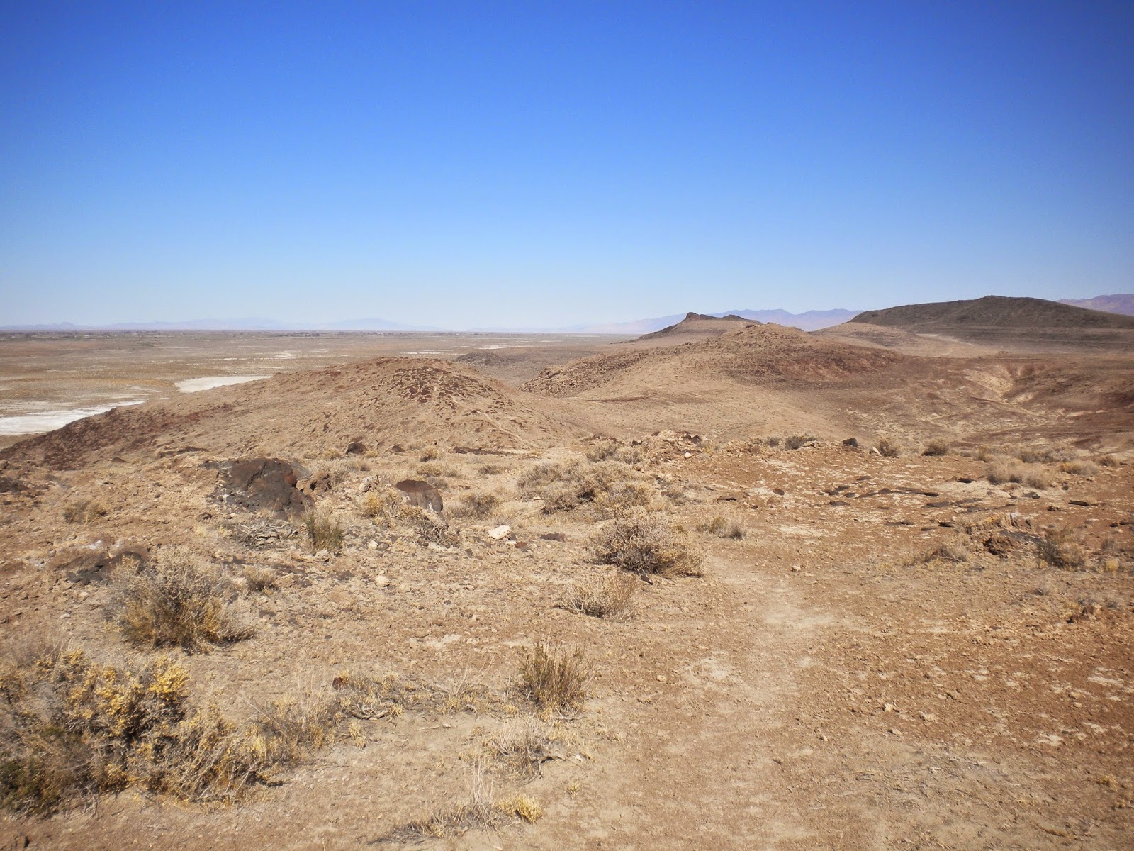
View north from the Overlook.
You can clearly see the steps in the hillside from ancient lake shores.

Heading east up the unofficial trail.
Heading north towards Hidden Cave.

Rocky terrain on the ridge top.

Petroglyphs on the Hidden Cave side.

This curvilinear style is common at Grimes Point.

This is the new or "new to me" petroglyph I spotted.
The "rake" design is common in this area.

Picnic Cave, directly across from Hidden Cave.

The trail heading back south.

Jeff ended up carrying Roxie for a ways. She was really tired from the heat.
We decided her trail name is "Bagpipes."

Jeff carrying Roxie aka "Bagpipes" with Dexter aka "Mr. Underfoot" following close behind.
No comments:
Post a Comment